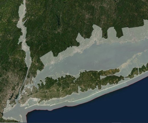
A map showing the Coastal Zone Management Act boundaries for each of the Mid-Atlantic states is now available in the Portal’s Administrative theme. First published on MarineCadastre.gov, the map represents the extent of the nation's coastal zone, as defined by the individual states and territories under the Coastal Zone Management Act of 1972 (CZMA).
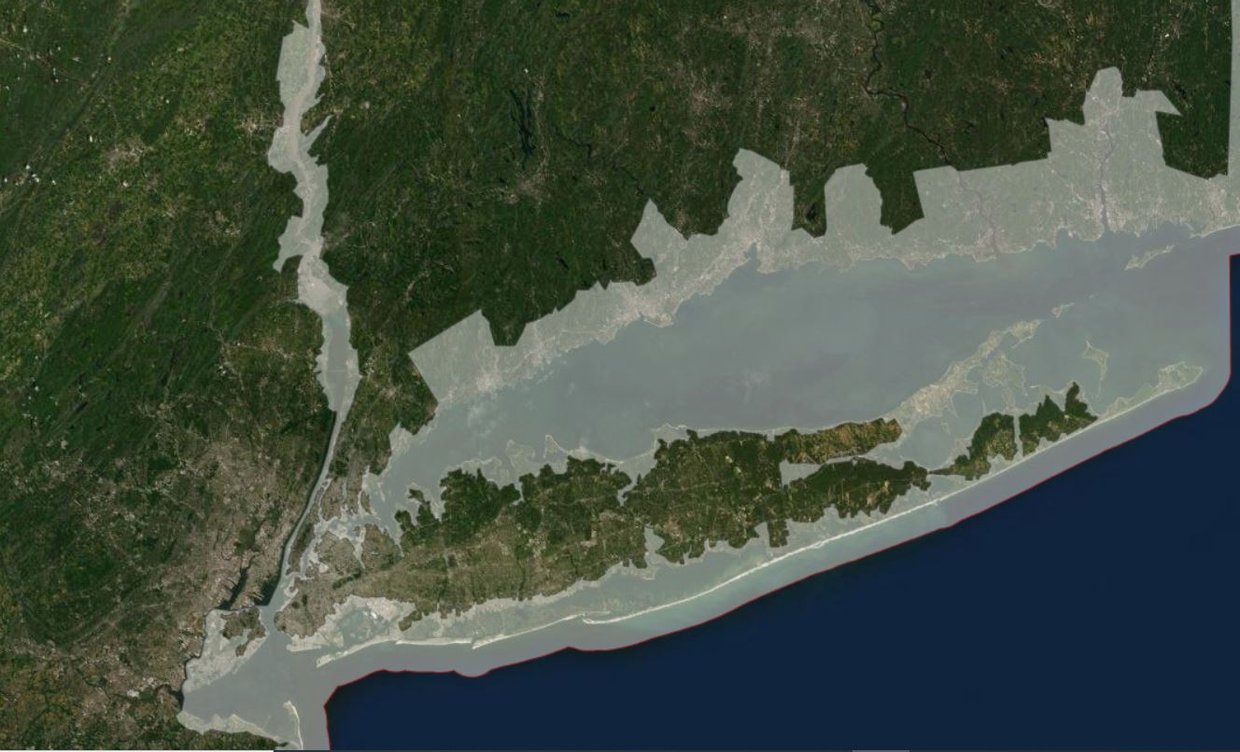
The CZMA was established to preserve, protect, develop, and where possible, to restore or enhance the resources of the nation's coastal zone. The zone generally extends seaward to the state-federal boundary (3 nautical miles offshore) defined by the Submerged Lands Act. It also extends inland from the shorelines to the extent necessary to control shorelands that have a direct and significant impact on coastal waters, including areas along the Delaware and Chesapeake Bays, Long Island Sound, and the Delaware, Hudson and Potomac rivers. The map also displays the U.S. exclusive economic zone boundary approximately 200 nautical miles from shore.
In the Mid-Atlantic, the entirety of Delaware lies in a CZMA zone and New York also has areas covered along its Great Lakes shoreline. The layer does not represent tribal boundaries.
About the Mid-Atlantic’s Coastal Zone Management Programs
Delaware: The Delaware Coastal Management Program was approved in 1979, and is a cooperative program between the State of Delaware and the National Oceanic and Atmospheric Administration, balancing coastal resource use, economic development and conservation to address a wide range of issues including coastal hazards, habitat protection, coastal development, water quality, public access, energy facility siting, and ocean planning.
Maryland: The Maryland Coastal Zone Management Program (CZMP) is a partnership among local, regional and state agencies. As a networked program, no one state agency or department is solely responsible for implementing the program along Maryland's entire coast; rather, all partner agencies help to ensure its proper management.
New Jersey: New Jersey’s Coastal Management Program (NJCMP) addresses some of today’s most pressing coastal issues, including sustainable and resilient coastal community planning, climate change, ocean planning, and planning for energy facilities and development. The NJCMP is comprised of a network of offices within the Department of Environmental Protection that serve distinct functions yet share responsibilities that influence the state’s coastal areas.
New York: In 1982, the New York State Coastal Management Program was created to establish the boundaries of the coastal area within which the CMP applies, describe the organizational structure to implement the CMP, and provide a set of statewide policies enforceable on all state and federal agencies which manage resources and coordinate actions along the state's coastline. State law also offers local governments the opportunity to participate in the state's Coastal Management Program on a voluntary basis.
Virginia: The Virginia Coastal Zone Management (CZM) Program is a network of Virginia state agencies and local governments, established in 1986 through an executive order, which administers enforceable laws, regulations and policies that protect coastal resources and foster sustainable development. The Department of Environmental Quality (DEQ) serves as the lead agency for Virginia’s networked program.