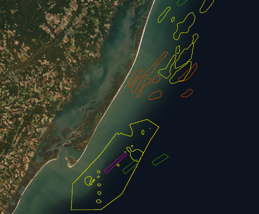
A Sand Resources map added to the Portal shows offshore areas where sediments usable for projects such as beach nourishment, shore protection and coastal wetlands restoration may exist. The map was created by the federal Bureau of Ocean Energy Management (BOEM) and first published on its Marine Minerals Information System (MMIS) application.
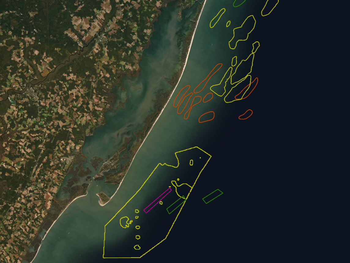
The areas are delineated in four colors that represent the level of confidence that usable sand resources are present: green for proven, yellow for potential, red for unverifiable, and pink for areas that have been deemed unusable although resources may be present. Users can click an area on the map for a popup containing information including its name, square footage, the volume of materials, and other data gathered about the sediments.
The sand resource areas were identified and characterized during governmental studies where various geological (e.g. sediment cores, sediment profile images) and geophysical (e.g. high-resolution swath bathymetry, side-scan sonar, seismic reflection profiles, magnetometer surveys) data were collected in the outer continental shelf (OCS) focus areas. BOEM will build on the dataset as updates from new studies become available.
The map can be found in the Portal’s Maritime theme by clicking on the “Sand” dropdown, which features data characterizing sediments as potential resources for human/industrial use. Other layers in the collection include Atlantic OCS Aliquots with Sand Resources, Beach Nourishment Projects, Federal OCS Sand and Gravel Borrow (Lease Areas) and Modeled Shoals in Federal Waters.
Portal users may also browse the Seafloor Habitat theme for several additional data layers pertaining to the Mid-Atlantic’s ocean bottom. It includes bathymetry layers that depict the topography of the ocean floor in detail; a “Seabed Forms and Sediments” dropdown containing maps that characterize the types of sediments on the floor and how currents impact their movements; data indicating habitat disturbance from fishing activity; and several other maps.