Coastal Virginia Offshore Wind Pilot Cable Alignment
Loading...
Recent Telecom Cables (2016-)
Loading...
Wrecks and Obstructions
Loading...
Routing Measures

Danger Zones & Restricted Areas
Loading...
BOEM Marine Minerals Lease Areas
Loading...
USACE National Sediment Management Framework Placement Areas

Military Installation Location
Loading...
Coastal Virginia Offshore Wind Pilot Turbine Locations
Loading...
Scallop 2015-2016 (<5 knots)
Loading...
BOEM Active Renewable Energy Leases
Loading...
Electric Transmission Lines: Voltage
Loading...
Landing a cable at Virginia Beach poses unique challenges. As home to the world’s largest Naval base, the waters present a veritable obstacle course for a cable alignment, with off-limits training zones and historic explosive dump areas narrowing the options for developers. The work was informed through analysis with GIS tools such as the Mid-Atlantic Ocean Data Portal and Marine Cadastre, extensive surveying by scientists at sea, and robust stakeholder outreach.
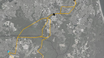
Dominion Energy Environmental Services Environmental Technical Advisor Scott Lawton described some of the major considerations that went into designing the alignment. A snapshot of these can be seen in the map above, with the CVOW cable shown in dark blue.
- Military Uses: The cable had to thread between two Naval “danger zones” shown in dotted pink lines above. Toward the end, the corridor was less than 2 miles wide. The line briefly crosses through a firing range area; the developers had to consult the Navy for permission to lay the cable during periods when it wasn’t in use. South of the corridor is an exclusion zone that was totally off limits, and to its north is an area where unexploded ordnances have been deposited.
- Maritime Uses: Shown in maroon to the cable’s north are federally designated traffic lanes which serve as the gateway to Chesapeake Bay for tankers and cargo ships from around the world. Lawton said it was important to steer clear of the lanes since they are periodically dredged and the massive vessels’ anchors can burrow deep into the ocean floor there, threatening the lines.
- Sediment Borrow/Deposit Areas: About 3 miles offshore, the line runs through the Dam Neck placement area, used by the U.S. Army Corps of Engineers (USACE) to deposit dredged materials from the shipping channels. Although sediments in the section it passes through are not actively being extracted for beach replenishment projects, the developers did have to gain permission from the USACE and bury the line deep beneath the area.
- Fisheries: Lawton said the developers were in frequent contact with members of the commercial and recreational fishing fleets to keep them apprised of their activities. A fishery liaison officer was hired as their “feet on the docks” and local captains were hired to scout the vicinity of the cable route for fishing activity and fixed gear such as crab pots, he said.
- Wrecks: The line needed to weave between the high number of shipwrecks along the ocean floor in the vicinity.
- Telecom Cables: The same narrow corridor used by the power line is shared by three recently constructed high-capacity telecommunications cables (seen in light blue). Agreements needed to be reached for the power line to cross over them, and mattressing was installed between them for protection.
Connecting Ashore

For the final approach to shore, Lawton said it was crucial for the alignment to hit the beach at a perpendicular angle. Because the tidal zone is sensitive to waves and shifting sands, the designers sought to pass through it as directly as possible.
The cable landed on the State Military Reservation property, chosen because it avoided the dense waterfront communities and tourist areas to the north and Naval training grounds to the south. The line runs underground to a nearby substation on the Naval Air Station Oceana grounds and from there the power is transmitted by traditional above-ground cables into the grid.
Lawton noted that when the full offshore wind area off Virginia Beach is developed, three substations will be constructed at sea to handle the vastly increased level of power being generated – 2.6GW versus the 12 MW being produced by the test turbines. Another nine cables are planned to follow a similar alignment to the first cable, but spaced out at least 100 feet from each other. They can’t be bundled together due to the heat they produce, and the spacing offers a measure of protection in the event one gets damaged by an anchor or fishing gear.
Directing enough electricity to power 660,000 homes into the grid will present a host of additional challenges, but Lawton notes, “That’s what Dominion Energy does. Once we hit the shore, we’re back in Dominion’s area of expertise. We’re used to doing transmission lines – it’s a part of our core function.”
Part of the work will entail continued communication with residents in the area as power lines are upgraded to handle the increased voltage. Stakeholder outreach has been a significant part of the project, with advisory groups formed to exchange information with advocacy and research organizations concerned with wildlife and environmental issues, including the safety of the endangered North Atlantic right whale; and standing calls scheduled with state and federal agencies. Discoveries made by their survey vessels have been shared with the National Oceanic and Atmospheric Administration, which has updated its publicly accessible (including on the Portal) nautical charts accordingly, Lawton said.
For government agencies and developers readying for cable siting projects across the country, Lawton offered the following advice.
“Educate, because this is new to everyone,” he said. “Start talking to your stakeholders early and often and don’t assume they know what you know, because they don’t. Treat them with respect, value their opinions, and see if there’s middle ground to be found.”
More on CVOW
For more information on the Virginia Coastal Virginia Offshore Wind project, visit these online resources:
- CVOW informational page on BOEM website
- Dominion Energy’s CVOW website
- CVOW-C Draft Environmental Impact Statement (DEIS)
Story by: Karl Vilacoba, Monmouth University Urban Coast Institute. He can be reached at kvilacob@monmouth.edu.
