Map Resources
Global, federal, regional, and state mapping resources.
Global
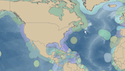
Ocean Biogeographic Information System (OBIS) allows visitors to search marine species datasets from all of the world's oceans.
Federal
MarineCadastre.gov is an integrated marine information system that provides authoritative and regularly updated ocean information.
NOAA's DigitalCoast provides data, tools, and training to help communities with coastal issues.
BOEM's National Marine Minerals Information System (MMIS) contains information on offshore sand and gravel resources throughout the U.S.
The NOAA OceanReports Tool allows you to draw a custom area anywhere in U.S. waters or pick from a predefined list of locations to get instant custom reports.
The NOAA ESA Section 7 Mapper allows users to click local waterways on a map to find out what endangered species may be present.
Regional
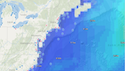
Mid-Atlantic Regional Association Coastal Ocean Observing System (MARACOOS) covers the region from Cape Cod, MA to Cape Hatteras, NC for U.S. IOOS. Its OceansMap provides real-time observational data including wind, wave, water level, salinity and temperature data.
Northeast Ocean Data Portal provides maps and data for ocean planning in the northeastern U.S.
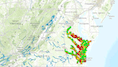
The Northeast Regional Habitat Assessment Data Explorer is a tool created by the Mid-Atlantic and New England fishery management councils that allows users to explore information on fish distribution and survey abundance, species life history, essential fish habitat (EFH), fish vulnerability to climate change and more.
State
Maryland's Coastal Atlas mapping tool allows users to view ocean data and access to tools to understand and balance multiple ocean uses.
New York Geographic Information Gateway provides public access to data, real-time information, interactive tools and expert knowledge relevant to the Office of Planning and Development’s activities throughout New York State.
Virginia Coastal Geospatial and Educational Mapping System (GEMS) is a gateway to Virginia's coastal resource data and maps.