Eight new data layers were recently added to the Portal’s Administrative, Water Quality and Oceanography themes. MARCO thanks our data-sharing partners for these additions.
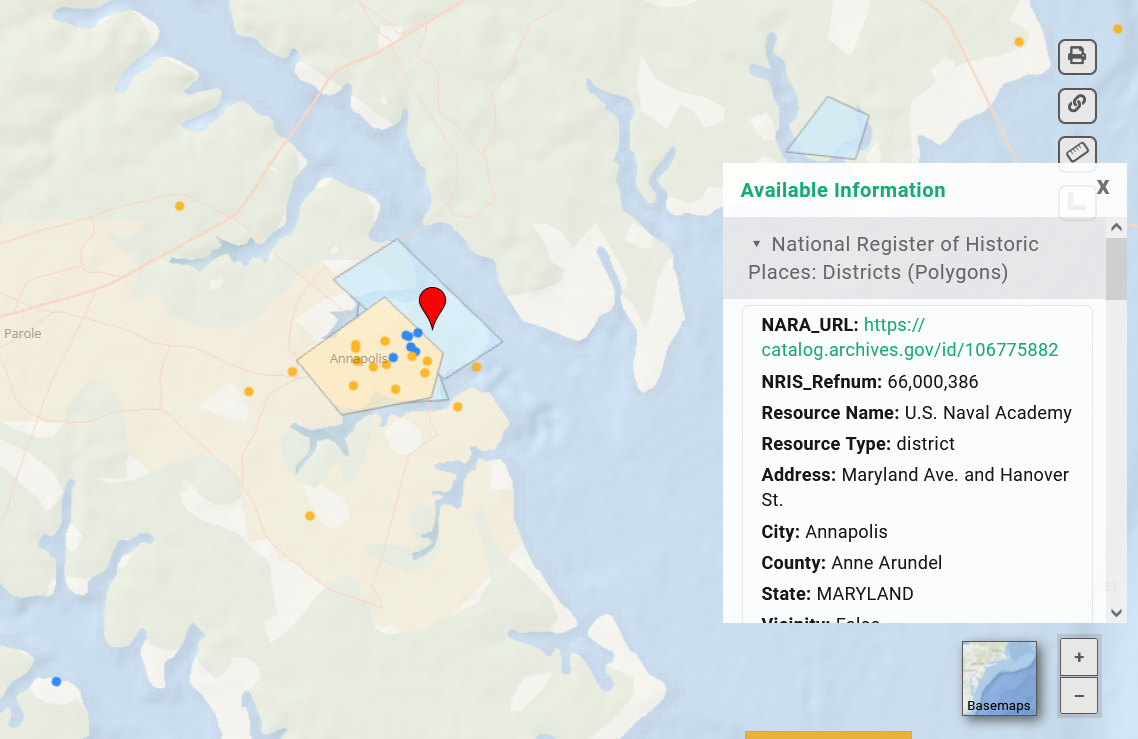
Historic Places: The National Register of Historic Places (Points) and National Register of Historic Places Districts (Polygons) maps show the locations of the nation’s official list of historic places worthy of preservation. Among them are historic and culturally significant sites along the coast and at sea, such as lighthouses, shipwrecks, and tourist destinations. Click any point or polygon for a popup containing details about the site. The data, provided by the National Park Service, can be found in the Administrative theme.
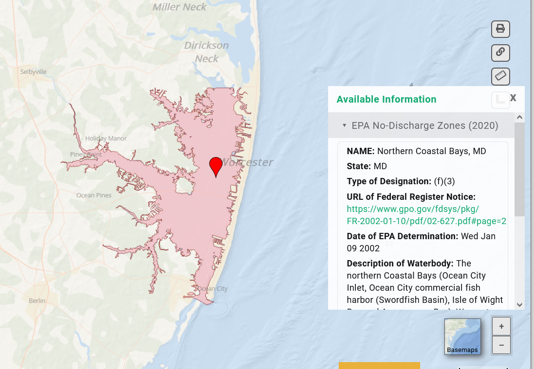
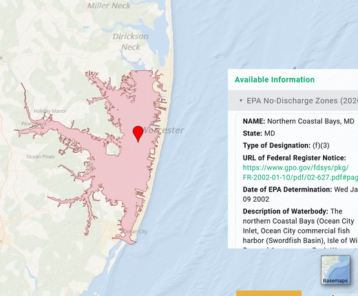
EPA No-Discharge Zones: Zones where the discharge of any treated or untreated sewage from vessels is prohibited. Click on any area for a pop-up containing a description of the waterbody, information about its designation, and more. The data, provided by the U.S. Environmental Protection Agency, can be found in the Water Quality theme.
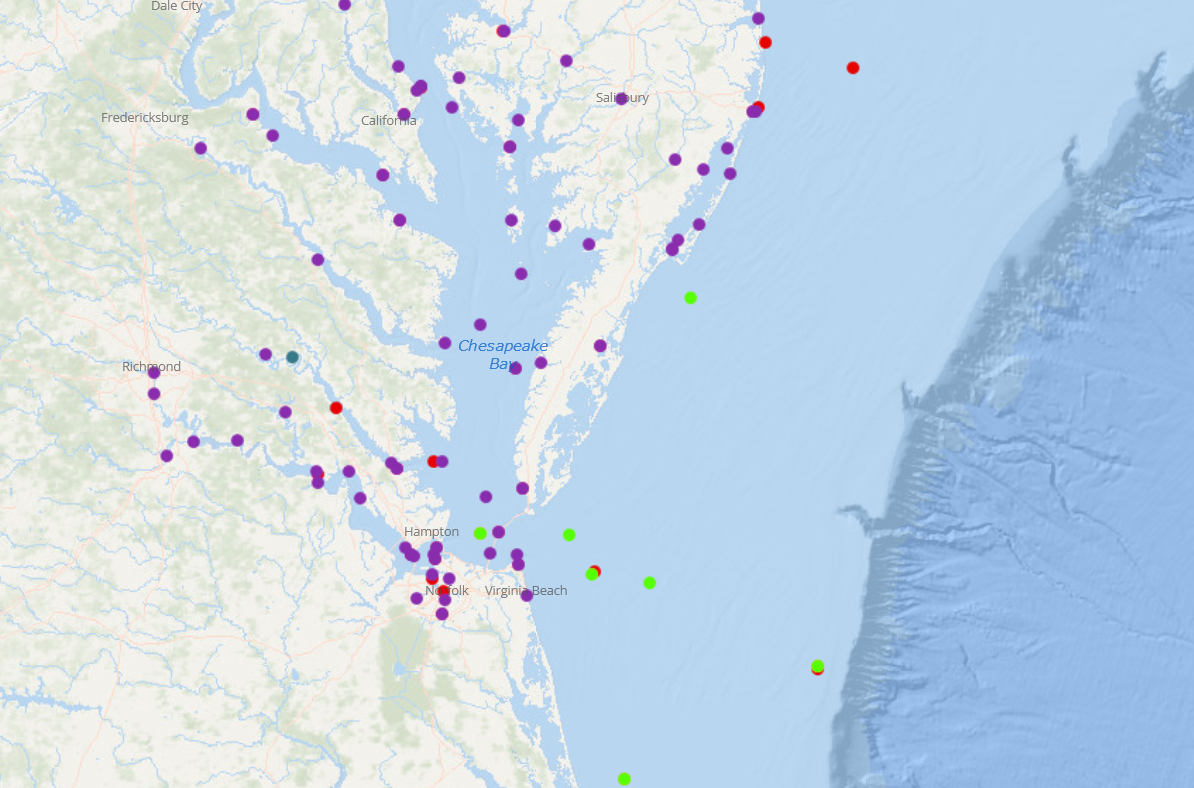
Federal Ocean Observation Buoys and Stations: The locations of buoys and monitoring stations that measure and record physical oceanographic and meteorological data. This dataset, prepared by northeastoceandata.org, compiles monitoring stations from several different sources/programs, which are shown in the map legend. The layer can be found in the Portal's Oceanography theme. Visit the MARACOOS OceansMap to view real-time data on local ocean conditions from these buoys.
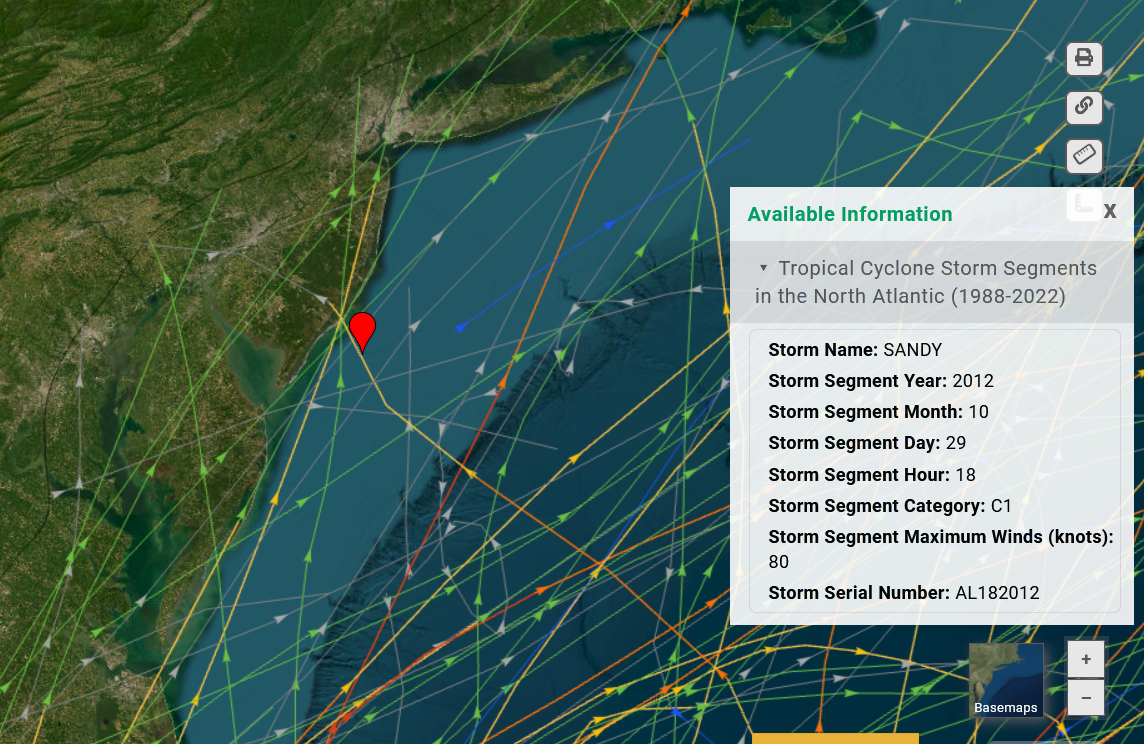
Historic Storms Updates: A Tropical Cyclone Storm Segments in the North Atlantic (1988-2022) layer has been added to replace a map that charted storm paths from 1980-2019. Additionally, the Tropical Cyclone Wind Exposure in the North Atlantic (1988-2022) has replaced a previous map that included data through 2016. Both of these maps, which are provided by MarineCadastre.gov, can be found by clicking the “Storms” dropdown in the Portal’s Oceanography theme.
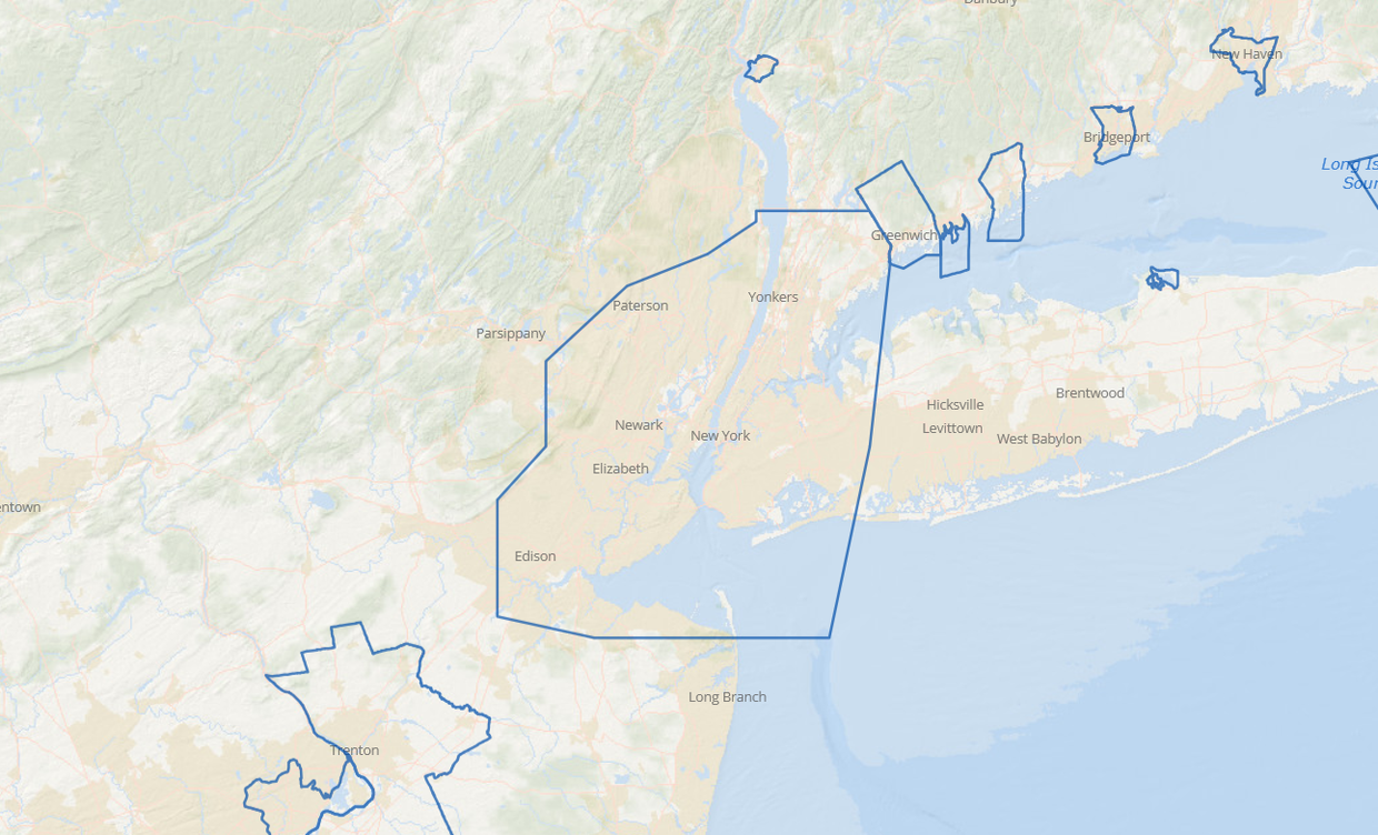
USACE Ports & Port Statistical Areas: The boundaries of port areas and the extents of port authorities and other port entities, such as the Port Authority of New York & New Jersey and the Port of Virginia. The data, provided by the U.S. Army Corps of Engineers, can be found in the Administrative theme.
118th Congressional Districts: Replaces the previous map in the Administrative theme showing the 117th Congressional boundaries. Click on any district for a popup containing information about its representative and links to their websites and social media accounts. Data provided by the U.S. Department of Transportation.
Questions about these datasets? Contact us at portal@midatlanticocean.org.