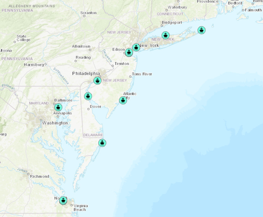
A new map on the Portal shows the locations of port facilities that are currently in use or are expected to accommodate offshore wind farm development in the Mid-Atlantic region.
The Offshore Wind Planned Ports map layer includes 15 sites in New York, New Jersey, Maryland and Virginia that were planned for these purposes as of December 2023. The map will be maintained to include any additional ports that are identified in the future.
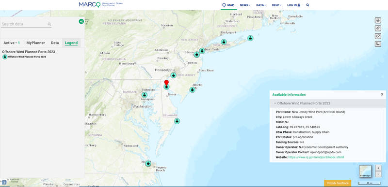
Users can click each point to learn the port’s name, location, status (e.g., operational, under construction), associated offshore wind projects, infrastructure assets, contact information and additional information. Where available, links are provided for offshore wind ports that have their own websites.
The map is available in the Portal’s Renewable Energy theme, along with over 80 other layers showing existing and proposed offshore wind project areas and infrastructure. The theme includes four collections of data that are ordered from the earliest to furthest along in the development process: The Planning and Lease Areas dropdown, which includes areas that have been or are being considered for leasing by the Bureau of Ocean Energy Management (BOEM); Offshore Energy Projects Under Review, which includes project envelopes and infrastructure locations that have been proposed and are under evaluation; Permitted Projects, which includes wind areas and infrastructure that have been approved and are under construction or clear to commence; and Operational Offshore Energy Projects.
For more information about offshore wind development on the Portal, view our Ocean Stories feature providing a state-by-state tour of lease areas in the Mid-Atlantic. Users can also click here for a listing of current and recent public comment opportunities regarding offshore wind projects.