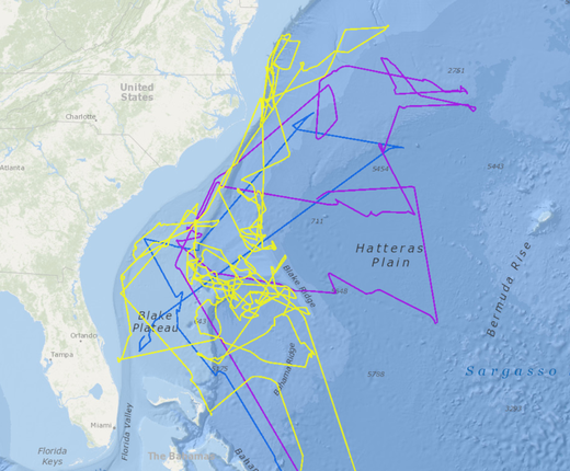
A new map layer depicting the first satellite tracks of the endangered black-capped petrel has been added to the Mid-Atlantic Ocean Data Portal in collaboration with the U.S. Geological Survey South Carolina Cooperative Fish and Wildlife Research Unit, U.S. Fish & Wildlife Service and Northeast Ocean Data Portal. Because of their low numbers, the distribution and abundance of endangered species can be difficult to map and model. Satellite tracking data provides a way for Portal users to better understand habitat and use areas of this species.
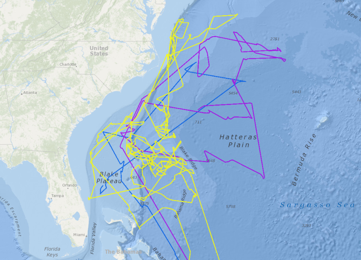
The Black-Capped Petrel Individual Movement Tracks layer shows the movement patterns of three black-capped petrels during their non-breeding season and can be accessed in Marine Planner’s Marine Life theme by clicking on the Bird Migrations dropdown. The tracking data were collected by Patrick Jodice and colleagues for a study published in Endangered Species Research.
The black-capped petrel (Pterodroma hasitata) is an endangered seabird with fewer than 2,000 breeding pairs restricted to a few breeding sites in Haiti and the Dominican Republic. To date, use areas at sea have been determined entirely from vessel-based surveys and opportunistic sightings and, as such, spatial and temporal gaps in our understanding of the species’ marine range are likely.
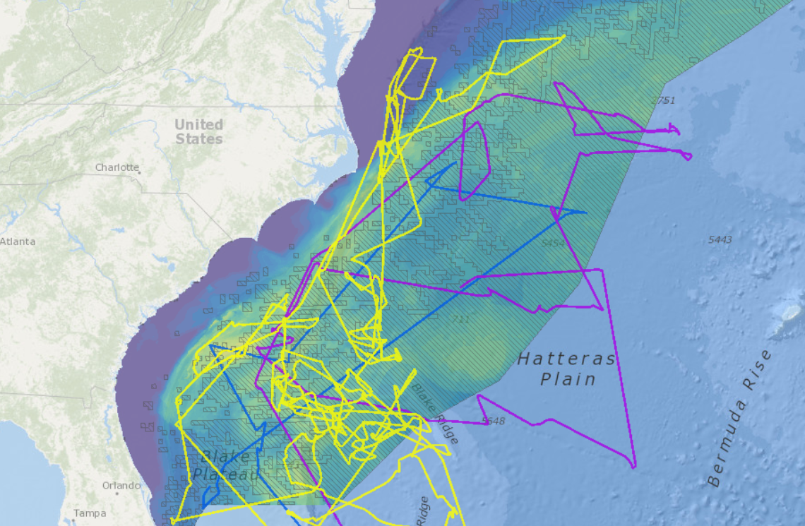
For example, compare these three individual tracks with the species distribution map that is available in the Portal’s Marine Life Library (Species Specific) theme. The distribution map was produced by the Marine-life Data and Analysis Team (MDAT) using models based on thousands of at-sea observations over several decades. As seen in the map at right, there is general agreement between the results of this tracking study and the MDAT summer model results for this species. However, it is clear from the MDAT Unsurveyed Area overlay (grey hatched layer) that the satellite tracks for black-capped petrel occurred primarily in areas where birds have not been surveyed extensively by ship or airplane. The location data derived from satellite tags also suggest a more spatially expansive range than the model outputs, including regular occurrence east of the Gulf Stream and outside the model domain.