Three new maps showing the approximate routes of
telecommunications and power lines and submerged oil and gas pipelines in the
Mid-Atlantic have been added to Marine Planner. For the convenience of users,
these layers have been grouped together under a new “Submarine Cables and
Pipelines” dropdown in the Maritime theme.
The new maps layers are:
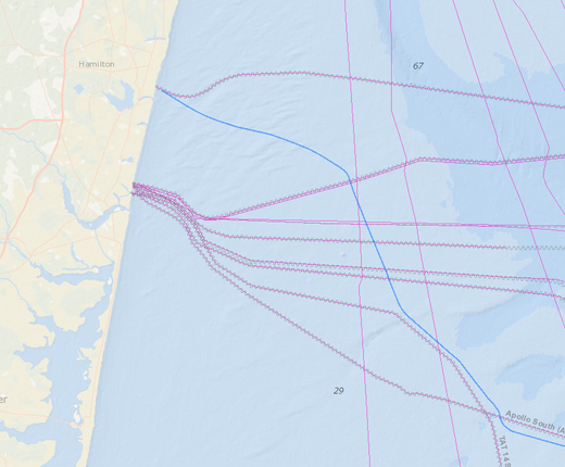
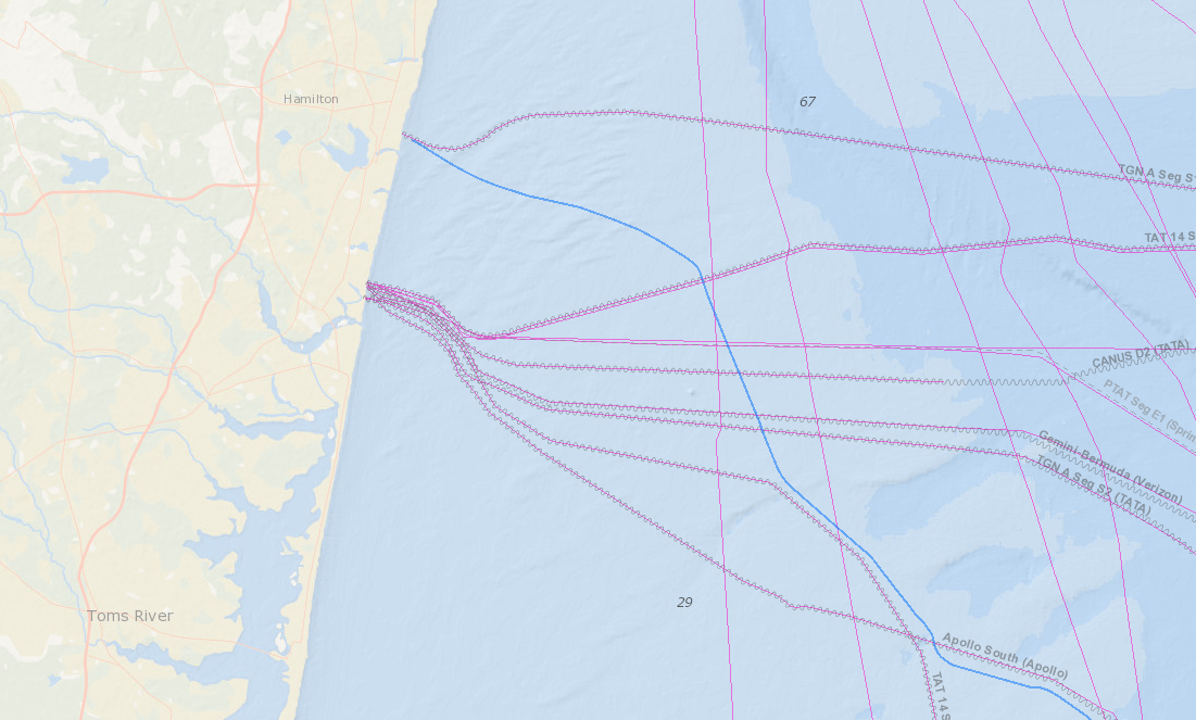
- Recent Telecom Cables (2016- ): Depicts submarine cable routes designed and constructed since 2016. The map currently includes the first two commercial telecom cables originating from the Virginia Beach area – Marea, which extends to Spain, and BRUSA, which connects to South America – as well as the Seabras-1 line which runs from New Jersey to South America. The data were provided by private owners and industry representatives for ocean planning purposes.
- NOAA Charted Submarine Telecom & Power Cables: Traces the routes of cables shown on NOAA’s nautical charts, as of 2012. The layer was first published on MarineCadastre.gov.
- Oil and Gas Pipelines: Shows the locations of submarine pipelines in coastal areas, both within state waters (rivers, bays, nearshore, etc.) and extending into the U.S. Outer Continental Shelf. The layer was first published on BOEM and NOAA’s OceanReports.
The Submarine Cables and Pipelines dropdown also includes a previously published NASCA Submarine Telecom Cables map. This data layer shows the locations of in-service and out-of-service cables in U.S. territorial waters that were owned by members of the North American Submarine Cable Association as of 2015. Learn more in our Ocean Stories profile of NASCA and the submarine cable industry.
Additional routes will be included in the Recent Cables layer
as data becomes available. The Portal Team thanks Subcom and Seaborn Networks for their
assistance in creating the map.