In addition to the many updates reported in our News section, the following data additions and enhancements were recently made to the Portal.
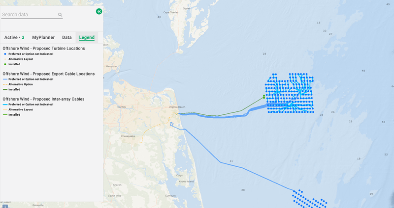
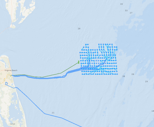
Installed Offshore Wind Infrastructure: The Offshore Wind - Proposed Turbines Locations, Proposed Export Cable Locations and Proposed Inter-array Cables map layers (click here to view) have been updated to delineate which infrastructure is installed vs. which infrastructure is still in the planning stages or proposed in federal waters (view map legends for explanation of colors). These changes can also be seen in the Vineyard Wind 1 Proposed Turbine/Inter-array/Export Cables maps, and will be reflected in other maps that are created to focus on individual projects as they progress to construction.
Balloon Litter: We’ve updated our Balloon and Other Debris Mid-Atlantic Beach Monitoring Surveys maps to include data for trash catalogued and removed in the fall of 2023. Click on any of the monitoring site locations from New York to Virginia for statistics.
Summer Flounder Small-Mesh Exemption Area: This map depicts the boundaries of the Summer Flounder Small-Mesh Exemption Area for the NOAA Fisheries Service’s Greater Atlantic Regional Fisheries Office.
In Case You Missed It
- The Coast Guard is seeking input through April 19 on a network of East Coast shipping safety fairways, which can be viewed on the Portal.
- We’ve added eight new maps that depict marine mammals along the East Coast that are vulnerable to climate change.
- A new map on the Portal shows the locations of offshore wind port facilities in the Mid-Atlantic.
- View our Current Agency Actions & Public Comment Opportunities page for a glimpse at the latest ocean planning activities in the region.
Questions or comments? Contact us at portal@midatlanticocean.org.